
Ottawa County Postal Coverage by ZIP
The official Ottawa County ZIP Code Boundaries layer returns ZIP and PostOfficeName values for polygons that meet the county area. The table lists the 23 distinct values returned in the August 2026 query. It is a geographic boundary list, not a statement that every postal area lies wholly within one municipality or that every label represents a county office. Use the parcel location and local unit to resolve the boundary.
| ZIP | Areas covered | Post office | Notes |
|---|---|---|---|
| 49315 | Ottawa County mapped area: Byron Center | Byron Center | Verify the Ottawa County parcel location. |
| 49318 | Ottawa County mapped area: Casnovia | Casnovia | Ottawa County postal geography is not municipal geography. |
| 49323 | Ottawa County mapped area: Dorr | Dorr | Verify the Ottawa County township and parcel. |
| 49330 | Ottawa County mapped area: Kent City | Kent City | Ottawa County GIS boundary value. |
| 49345 | Ottawa County mapped area: Sparta | Sparta | Ottawa County GIS boundary value. |
| 49401 | Ottawa County mapped area: Allendale | Allendale | Ottawa County local postal label. |
| 49403 | Ottawa County mapped area: Conklin | Conklin | More than one Ottawa County polygon in the layer. |
| 49404 | Coopersville | Coopersville | More than one Ottawa County polygon in the layer. |
| 49415 | Fruitport | Fruitport | Ottawa County boundary touches or enters the mapped area. |
| 49417 | Grand Haven | Grand Haven | Check the Ottawa County city line for the parcel. |
| 49418 | Grandville | Grandville | Do not equate the label with an Ottawa County municipality. |
| 49423 | Holland | Holland | Check Ottawa County city, township, and county lines by parcel. |
| 49424 | Holland | Holland | Separate Ottawa County value from 49423. |
| 49426 | Hudsonville | Hudsonville | More than one Ottawa County polygon in the layer. |
| 49428 | Jenison | Jenison | Ottawa County adjacent-county postal label. |
| 49435 | Marne | Marne | Ottawa County GIS boundary value. |
| 49448 | Nunica | Nunica | More than one Ottawa County polygon in the layer. |
| 49451 | Ravenna | Ravenna | Ottawa County GIS boundary value. |
| 49456 | Spring Lake | Spring Lake | Check the Ottawa County village and township boundary. |
| 49460 | West Olive | West Olive | Ottawa County administration postal context. |
| 49464 | Zeeland | Zeeland | Ottawa County city and township lines can differ. |
| 49534 | Grand Rapids | Grand Rapids | Verify the exact Ottawa County parcel. |
| 49544 | Grand Rapids | Grand Rapids | Verify the exact Ottawa County parcel. |
Duplicate polygon rows do not make extra postal codes. The Ottawa County service shows multiple polygons for several values, including 49403, 49404, 49417, 49423, 49426, 49448, 49456, and 49460. No official Ottawa source located a per-ZIP population, registration count, PO-box-only status, unique-institution status, or historic realignment date, so none should be inferred from the boundary layer.
Ottawa County GIS Postal Values
Ottawa County's GIS service returns 23 distinct postal values, even though its layer can draw a value as more than one polygon. That is a useful map lesson: postal delivery areas are not a simple city list. The layer has ZIP and PostOfficeName attributes, which makes it the county's clearest public starting point for a ZIP-based geographic question.
The official Ottawa County ZIP boundary layer is the source shown below.
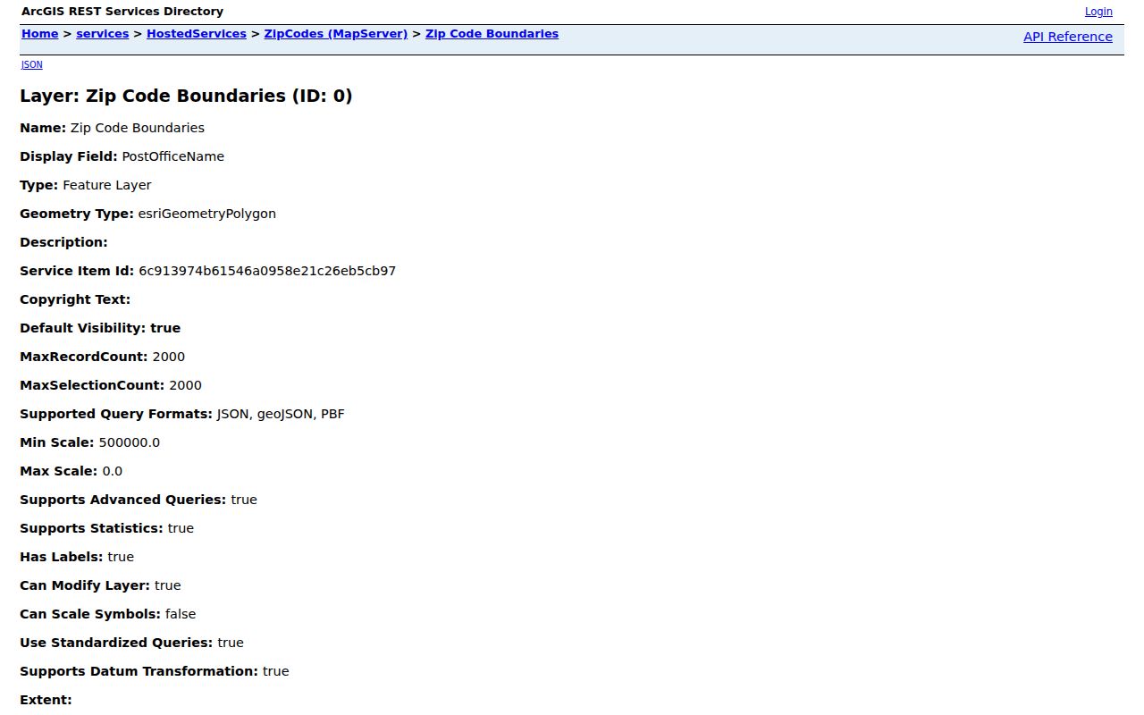
Use the map as an Ottawa County boundary and routing aid, then identify the parcel in Ottawa County GIS before relying on a postal-city label. A ZIP match does not establish a city limit, voting jurisdiction, property ownership, or household occupancy.
Note: Count distinct ZIP values, not every polygon returned by the Ottawa County GIS boundary service.
USPS ZIP Fields in Ottawa County
Use the USPS ZIP Lookup to verify the postal piece before checking a county map or record. Its available modes are By Address, By City and State, and Cities by ZIP. USPS verification confirms an address-to-postal result. It does not confirm that a named person or company is at the address.
| USPS input or option | Captured behavior |
|---|---|
| Company | Optional. |
| Street Address | Required in the address mode. |
| Apt, Suite, or Other | Optional. |
| City and State | Required in the address mode. |
| Urbanization Code and ZIP | Optional. |
| Results pagination | Choices of 10, 20, or 30. |
The tool can settle a spelling or postal-label question before an Ottawa County parcel search. It does not replace the county GIS layer or a local government jurisdiction check.
Find an Ottawa County Address by ZIP
A ZIP code narrows an Ottawa County search geographically. It does not create a ZIP-wide public resident list. The county property portal's captured screen accepts owner name, parcel number, and house number with street name, but it did not expose a ZIP filter. Michigan voter tools route by jurisdiction and precinct rather than postal area. Use the ZIP to verify and map an address, then use the parcel and local records paths.
- Verify the street address and postal result through the USPS lookup.
- Check the matching polygon in the Ottawa County ZIP boundary layer and note where it meets another postal label.
- Open the Ottawa County Property Search with the house number and street name, or find the parcel through Ottawa County Property Mapping.
- Identify the local city, village, or township from the parcel, then use that custodian for permit, zoning, code, or clerk records.
Once a postal area has been narrowed to an address, the Ottawa County Street Directory provides the address-by-address parcel and deed workflow. Keep a ZIP as a map filter, not as evidence of an entire household.
Ottawa County Parcels After a ZIP Search
Property work begins after the postal check. The Ottawa County property portal links Property Information, Property Summary, Tax Description, Sales History, Split History, and Parcel Report. Its parcel search uses segmented numbers beginning with 70 in the observed portal. Preserve the number exactly as the live field displays it. Parcel IDs and legal descriptions bridge an address to the deed index when a road name is too new or too vague for an older document.
Map to parcel, then property record, then legal description, then deed index. The Ottawa County deed search accepts name, recording dates, document type, liber and page, instrument number, and parcel segments. A deed proves a recorded land transaction, while the GIS map supplies geography. Neither one alone proves current occupancy. If the property result needs local correction or context, the county notes that local assessing units maintain much of the owner and address data.
Note: No local assessor ZIP-wide filter was verified in the captured Ottawa County property portal.
Postal Cities Across Ottawa County
Ottawa County lies between Lake Michigan, Muskegon County, Kent County, Allegan County, and an array of city and township systems. Holland, Zeeland, Grand Haven, Spring Lake, Ferrysburg, Hudsonville, Jenison, Allendale, and rural townships can have different permit, zoning, cemetery, election, and clerk custodians even when nearby addresses look similar in mail. The postal label is therefore a useful search clue, not the final government jurisdiction.
The Ottawa County local-contacts directory is the record-routing check after the map. It lists local units whose records are separate from county records. This is especially important near a postal boundary: an address carrying a Grandville, Grand Rapids, Fruitport, Byron Center, or Jenison label may still need a parcel-by-parcel check before a request is sent. Municipal boundaries, county boundaries, and postal polygons are distinct geographies.
Holland's Two Ottawa County ZIPs
The Ottawa County GIS layer separately returns 49423 Holland and 49424 Holland. A shared postal-city name does not make the two values interchangeable. Start with the full address in USPS, map the resulting area in the county layer, and check the parcel before treating either number as a city or township boundary. This small distinction prevents a postal search from being used as a shortcut for local jurisdiction.
Holland also has address-history resources that use a different set of keys. The Herrick District Library house-history guide points researchers to address directories, maps, newspapers, the Register of Deeds, and local archives. The Holland Museum holds house-numbering certificate books beginning in 1908. Those sources can help reconcile an earlier address but do not turn a postal label into a current-resident record.
Historic Ottawa County Postal Clues
Historic research needs more than a modern ZIP. The Library of Congress offers an 1883 Grand Haven Sanborn set with 18 sheets and a 1912 set with 24 sheets. Both include Grand Haven, Spring Lake, Ferrysburg, and Fruitport. They can show a building footprint, street setting, or road pattern that helps line up a directory, deed, newspaper, or permit clue.
Those maps do not show modern postal boundaries or a current household. Use a historic map to test address continuity, then return to the Ottawa County parcel, legal-description, and local-history records. When a road number changed, a lot and block, owner surname, or adjacent parcel can be more durable evidence than a later postal address.
Ottawa County ZIP Directory Terms
The Ottawa County ZIP code directory uses postal vocabulary that is useful for verification but should not be confused with parcel or municipal-record terms.
- ZIP code
- A USPS postal-routing code. It can cross a city, township, or county boundary.
- ZIP+4
- An added four-digit routing detail used with a base ZIP; it does not establish a government jurisdiction.
- PO-box ZIP
- A ZIP assigned for post-office boxes. No Ottawa County PO-box-only status was verified in the research, so do not assume one from a label.
- Unique ZIP
- A ZIP assigned to one organization or institution. No Ottawa County unique-ZIP status was verified in the official material.
- Carrier route
- A postal delivery grouping used within a ZIP area, not a parcel number or a municipal boundary.
An Ottawa County ZIP code directory is strongest when it stays in that role: verify the postal label, map the geography, inspect the parcel, and contact the custodian that actually holds the record.